John Speed Art

to
1
4
Overall Width
to
Overall Height
to
4
1
4
4
4
4
4
3
3
1
4
4
11,814
2,887
2,541
1,618
3
1
Artist: John Speed
AMERICA
AMERICA

John SpeedAMERICA, 1626-76

$4,250Sale Price|50% Off

AMERICA

By John Speed

Located in Santa Monica, CA

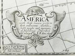
IMPORTANT AMERICAN MAP - ONE OF THE FIRST TO SHOW CALIFORNIA as an ISLAND JOHN SPEED (1552-1629) AMERICA - With Those Known Parts In That Unknown Worlde (sic), 1626-(76) (Burden 217 iv/iv) Engraving, uncolored. Engraved by Abraham Goos and published by Thomas Basset and Richard Chiswell - 4th state of 4 in 1676.15 1/8 x 20 1/2” From “A Prospect of the Most Famous Parts of the World”. Generally good condition. A repaired split in lower centerfold. This is the most common version of this important map...

Category

1620s Old Masters John Speed Art

Materials

Engraving

John Speede Map The Countye of Monmouth

John Speede Map The Countye of Monmouth

By John Speed

Located in London, GB

To see our other views and maps of England - including London, Oxford and Cambridge, scroll down to "More from this Seller" and below it click on "See all from this Seller" - or send...

Category

17th Century Realist John Speed Art

Materials

Engraving

John Speede, Map of the County of Surrey, described and divided into hundreds

John Speede, Map of the County of Surrey, described and divided into hundreds

By John Speed

Located in London, GB

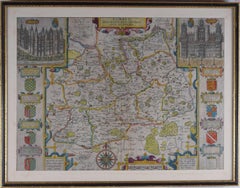
To see our other views and maps of England - including London, Oxford and Cambridge, scroll down to "More from this Seller" and below it click on "See all from this Seller" - or send us a message if you cannot find the view you want. John Speed/Speede (1551/2-1629) The County of Surrey Described and Divided into Hundreds Engraving with later hand colouring and text to the reverse.  Dated to c.1650 36 x 49 cm Probably the most famous early English mapmaker, John Speed's early life is somewhat of an enigma. He is believed to have trained as a rolling-press printer, but he was at heart an historian granted a sinecure in the Customs House by Queen Elizabeth to indulge his passion, later becoming a Fellow of the Society of Antiquaries. His first maps were historical, of the Holy Land 'Canaan as it was Possessed both in Abraham and Israels Dayes' and of England and Ireland recording 'all their Civill Warres since the Conquest'. In 1611 he published his 'Hostory of Great Britaine' which he regarded as his magnum opus, but it was the companion atlas 'Theatre of the Empire of Great Britaine' that - as the first printed atlas of Great Britain - sealed his reputation. William Rogers engraved the first map, 'the County Palatine of Chester' in about 1600, but following his untimely death the task of engraving was passed to Jodocus Hondius of Amsterdam. By 1612 the atlas was complete, the maps famed for their decorative elements. Many have town plans - Britain's first series of such plans - and descriptive text was printed to the reverse until the 1676 edition. Later printings (up until 1770) were issued without this text. By 1627 it has become a part of a world atlas 'Prospect of the Most Famous Parts of the World'. During the 17th century the plates passed through the hands of a series of publishers, the 1676 edition of Thomas Bassett and Richard Chiswell being regarded as its high point with the inclusion for the first time of a series of important maps. For the first half of the eighteenth century they were firmly established in the hands of the Overton family. This particular edition originally featured in The Theatre Of The Empire Of Great Britaine. It features attractive inset views of the long-since destroyed Richmond...

Category

17th Century Realist John Speed Art

Materials

Engraving

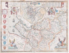
John Speede Map The Countye Palatine of Chester with that most ancient citie

John Speede Map The Countye Palatine of Chester with that most ancient citie

By John Speed

Located in London, GB

To see our other views and maps of England - including London, Oxford and Cambridge, scroll down to "More from this Seller" and below it click on "See all from this Seller" - or send...

Category

17th Century Realist John Speed Art

Materials

Engraving

Related Items
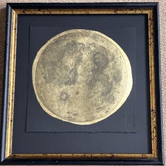
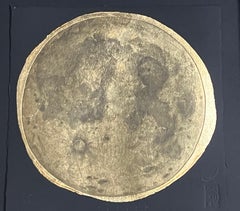
'Sister,  A portrait of the Moon' , Signed Etching c2021

'Sister, A portrait of the Moon' , Signed Etching c2021

Located in Frome, Somerset

'Sister' , by contemporary printmaker and artist Rosie McLay (British) Edition 59 of 75 in total, handmade etching by the artist. Ink on paper layed on Dutch gold leaf. Hand etched ...

Category

2010s Realist John Speed Art

Materials

Engraving

Daniel Marot's The Siege of the Dutch Fortified City of Ypres by Louis XIV

Daniel Marot's The Siege of the Dutch Fortified City of Ypres by Louis XIV

By Daniel Marot

Located in Alamo, CA

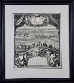
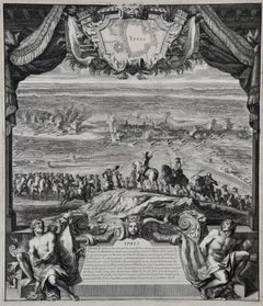
"Ypres, Grand Ville Riche & Marchande" is an engraving and etching by Daniel Marot (le Vieux) (1661–1752). It depicts a view of the siege of the city of Ypres and its citadel on the left in the Spanish Netherlands by Louis XIV's troops. This battle took place between March 18 and March 25, 1678, as part of the Franco-Dutch War. Marot illustrated in great detail (best appreciated with magnification) the French attack on the strong pentagonal citadel on the extreme left, which had been built recently in anticipation of a French attack. The trenches built by the French approaching the town are seen on the right. King Louis XIV can be seen in the foreground surveying the battle mounted on his white horse, surrounded by his officers and troops. The print is presented in an attractive ornate black wood frame with a cream-colored double mat with a black inner trim. It is glazed with plexiglas. The frame measures 25.38" x 22.63" x .88". The engraving, frame, mat and glazing are in excellent condition. Artist: Daniel Marot (1661–1752) was also called "Le Vieux". He was the son of the famous architect, Jean Marot. Marot had diverse interests and talents. In addition to his art, he designed garden projects, architectural ornaments, furniture, and even upholstery. Marot as a Huguenot protestant was forced to leave France in 1685 following the revocation of the Edict of Nantes. He emigrated to Holland, where he worked for William of Orange (an arch enemy of his former employer Louis XIV). Marot was largely responsible for the interiors of Williams palace at the Loo. In 1694 he went Britain as William had married Queen Mary and he had become King William III of England. He later returned to Holland in about 1698 and died in the Hague in 1752. He left a lasting legacy on the decorative arts in the Netherlands, where his grand version of the Louis XIV style remained popular into the 1730s. Historical Background: In October 1677, Mary Stuart, niece and possible successor of Charles II of England, married Louis XIV's arch enemy William III of Orange...

Category

Late 17th Century Old Masters John Speed Art

Materials

Engraving, Etching

"A Dance in Otaheite" (Tahiti), Engraving from Captain Cook's 3rd Voyage

"A Dance in Otaheite" (Tahiti), Engraving from Captain Cook's 3rd Voyage

By John Webber

Located in Alamo, CA

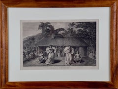
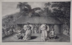
"A Dance in Otaheite" (Tahiti) is an engraving created by William Sharp (1749-1824), from a drawing by John Webber (1752-1793), who was the artist on Captain James Cook's 3rd and final voyage of discovery. It is a plate in the atlas of "A Voyage to the Pacific Ocean Undertaken by the Command of His Majesty, for Making Discoveries in the Northern Hemisphere", the official British Admirality sanctioned journal published upon completion of the voyage in London in 1784 by Strahan & Cadell. Two women and two men wearing ceremonial costumes, performing a dance outdoors standing on a mat. Three men are playing the drums in the background, in front of a thatched roof building. An audience of men are sitting on both sides of the stage. By the time Webber arrived in Tahiti, 'south sea' imagery had become familiar. Webber gave concentrated attention to dance. He had the opportunity to distinguish the Tahitian dance from the more formalized dancing of Tonga. Whereas they seem to have called to mind the more formal dances of antiquity, the Tahitian dancing aroused memories of peasant and folk dancing. This engraving is professionally framed in Koa wood. Koa wood is legendary in Hawaii. Not only is this amazing wood native to Hawaii, but it is known for the deep rich colors and varied grain pattern. Koa has an honored heritage in Hawaii and is highly revered and sacred. The word “koa” means “warrior” in Hawaiian. The warriors of King Kamehameha the Great, created canoes and weapons from a wood plentiful on the Big Island of Hawaii. This wood became synonymous with the warriors themselves, and it became known as koa. The print is in excellent condition. There are three other engravings listed from the official journal of Captain Cook's 3rd voyage available that are presented in identical Koa wood frames and double mats (LU117324682432, LU117324684052, LU117324684062). They would make a wonderful grouping for a display of 2, 3 or 4 prints. A discount is available for a grouping depending on the number of items included. Hawaii was discovered by Captain Cook during this voyage. Hawaii was originally called The Sandwich Islands in honor of The Earl of Sandwich...

Category

1780s Realist John Speed Art

Materials

Engraving

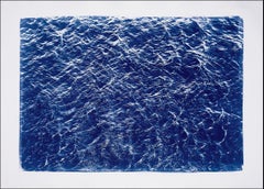
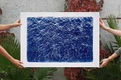
Pacific Ocean Currents, Handmade Cyanotype Seascape in Blue, Waves Landscape

Pacific Ocean Currents, Handmade Cyanotype Seascape in Blue, Waves Landscape

By Kind of Cyan

Located in Barcelona, ES

This is an exclusive handprinted limited edition cyanotype. "Pacific Ocean Currents" is a handmade cyanotype print of rough water texture resembling Pacific Ocean swell. Details: + ...

Category

2010s Realist John Speed Art

Materials

Paper, Emulsion, Engraving, Etching

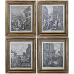
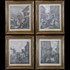
Four Framed Hogarth Engravings "Four Times of the Day"

William HogarthFour Framed Hogarth Engravings "Four Times of the Day", 1738, 1822

$5,420Sale Price|20% Off

H 25.75 in W 22.25 in D 1.88 in

Four Framed Hogarth Engravings "Four Times of the Day"

By William Hogarth

Located in Alamo, CA

The four plates in this "Four Times of the Day" set were created utilizing both engraving and etching techniques by William Hogarth in 1738. Hogarth's original copper plates were refurbished where needed by James Heath and these engravings were republished in London in 1822 by Braddock, Cradock & Joy. This was the last time Hogarth's original copper plates were used for printing. Most were melted down during World War I for the construction of bombs. Printed upon early nineteenth century wove paper and with large, full margins as published by William Heath in 1822. The inscription below each print reads "Invented Painted & Engraved by Wm. Hogarth & Publish'd March 25. 1738 according to Act of Parliament". These large folio sized "Four Times of the Day" engravings/etchings are presented in complex gold-colored wood frames with black bands and scalloped gold inner trim. A majority of each thick impressive frame is covered with glass applied near the outer edge. Each frame measures 25.75" high, 22.25" wide and 1.88" deep. There are a few small dents in the edge of these frames, which are otherwise in very good condition. "Morning" has two focal areas of discoloration in the upper margin and some discoloration in the right margin, a short tear in the left margin and a short tear or crease in the right margin. "Noon" has a spot in the upper margin that extends into the upper image, but it is otherwise in very good condition. "Evening" has a faint spot in the upper margin, but it is otherwise in very good condition. "Night" is in excellent condition. The "Four Times of the Day" series is in the collection of many major museums, including: The British Museum, The Metropolitan Museum of Art, The Tate Museum, The Chicago Art Institute and The Victoria and Albert Museum. Through this series Hogarth is portraying early 18th century London street life at "Four Times of the Day". His characters are exhibiting their personalities, quircks, strange activities, but he also wants to draw attention the disparities between the wealthy aristocracy and the common working class. Plate 1, "Morning" depicts morning in Covent Garden in the winter in front of Tom King...

Category

Mid-18th Century Old Masters John Speed Art

Materials

Engraving, Etching

Venice Beach Seascape, Long Wave, Nautical Scene in Blue Tones, Limited Edition

Venice Beach Seascape, Long Wave, Nautical Scene in Blue Tones, Limited Edition

By Kind of Cyan

Located in Barcelona, ES

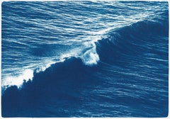
This is an exclusive handprinted limited edition cyanotype. This beautiful cyanotype is titled "Long Wave in Venice Beach" and it shows an outstanding wave in one of the most iconic ...

Category

2010s Realist John Speed Art

Materials

Paper, Emulsion, Watercolor, Engraving, Etching, Monotype

Tournai (Tournay), Belgium: A 16th Century Hand-colored Map by Braun & Hogenberg

Tournai (Tournay), Belgium: A 16th Century Hand-colored Map by Braun & Hogenberg

By Franz Hogenberg

Located in Alamo, CA

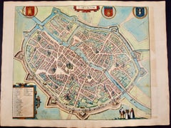
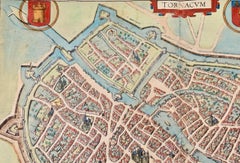
This is a 16th century original hand-colored copperplate engraved map of Tournai, Belgium, entitled "Tornacum" by Georg Braun & Franz Hogenberg, in volume IV of their famous city atlas "Civitates Orbis Terrarum", published in Cologne or Augsberg, Germany in 1575. The map provides a bird's-eye view of the walled city of Tournai, the second oldest city in Belgium. It lies approximately one hour by car southwest of Brussels or from Ghent. The names of thirty of its streets, prominent buildings, churches and squares are listed in a key within a strap-work cartouche in the lower left. These locations are numbered in the key corresponding to their locations on the map. This colorful map of Tournai (Tornacum or Tournay as it was called in the 16th century) includes the title in Latin in a cartouche in the upper center. Three crests are present across the upper map. A man and two woman are standing on a hill in the foreground in the lower right dressed in the style of 16th century upper class residents of the town. This is an English translation of an excerpt of Braun's description of Tornai: “Tornacum or Turnacum is a city in Gallia Belgica, situated on the Schelde in the territory of the Nervii, called Tournai by its French inhabitants, but Dorneck by the Germans. Tournai has always been a large and powerful city, with an abundance of goods and commercial activities and wonderfully resourceful craftsmen, who invent new articles every day, and although some of these go out of use they constantly conceive of other new things, both useful and delightful, so that they have at all times something that provides work and a means of livelihood for the poor." ReferencesVan der Krogt 4, 4435, State 1; Taschen, Braun and Hogenberg...

Category

16th Century Old Masters John Speed Art

Materials

Engraving

Frankfort, Germany: A 16th Century Hand-colored Map by Braun & Hogenberg

Frankfort, Germany: A 16th Century Hand-colored Map by Braun & Hogenberg

By Franz Hogenberg

Located in Alamo, CA

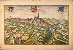
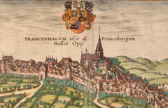
This is a 16th century original hand-colored copperplate engraved map of Frankfort, Germany entitled "Francenbergum, vel ut alij Francoburgum Hassiae Opp" by Georg Braun & Franz Hogenberg, from their famous city atlas "Civitates Orbis Terrarum", published in Cologne, Germany in 1595. This is an English translation of an excerpt from the original text in the atlas: "Frankenberg or, according to others, Francoburgum, a town in Hesse. Charlemagne vested the town of Frankenberg with many freedoms and privileges, which it still enjoys to this day, and on account of its valiant and victorious soldiers awarded a signet, upon which there formerly appeared a golden castle with a tower, together with the letter F and a golden crown. Frankenberg, seen here from the northeast, lies on a hill above the River Eder. The hillside is covered with fields neatly separated by bushes and fences. Soaring above the town is the massive Liebfrauenkirche, which was modelled on St Elizabeth's church in Marburg. The New Town was founded in 1335 at the foot of the hill (right) and merged with the Old Town as late as 1556. Frankenberg was founded by Conrad of Thuringia in 1233/34 to prevent the archbishops of Mainz from expanding their sphere of influence...

Category

16th Century Old Masters John Speed Art

Materials

Engraving

Vatican Hallway designed by Raphael: 18th C. Hand-colored Engraving by Volpato

Vatican Hallway designed by Raphael: 18th C. Hand-colored Engraving by Volpato

By Giovanni Volpato

Located in Alamo, CA

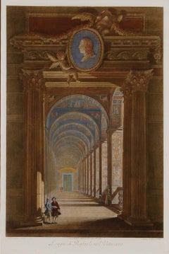
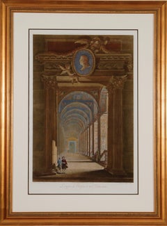
This is an original 18th century hand-colored framed copper-plate engraving by Giovanni Volpato after a drawing by Camporesi. It was the frontispiece for volume one of the rare and v...

Category

Late 18th Century Old Masters John Speed Art

Materials

Engraving

View of Seravalle, Italy: A 16th Century Hand-colored Map by Braun & Hogenberg

View of Seravalle, Italy: A 16th Century Hand-colored Map by Braun & Hogenberg

By Franz Hogenberg

Located in Alamo, CA

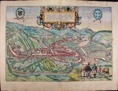
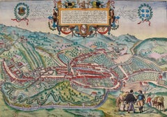
This is an original 16th century copperplate originally hand-colored engraved map of View of Seravalle, Italy entitled "Seravallum Celeberrimum Marchiae Tarvisiniae in Agro Foro Juliensi Opp. - Seravalli, quam vides, Spectator, iconem, operi huic nostro suis sumptib. . . ." by Georg Braun & Franz Hogenberg, from their famous city atlas "Civitates Orbis Terrarum", published in Augsberg, Germany in 1575. The map depicts a view of Seravalle, now Vittorio Veneto, in San Marino, Italy, north of Venice, in a topographically accurate bird's-eye view from the south. A water-filled moat is seen to the south of the city walls and farmland to the east. Two men are depicted standing on a hill in the lower right in conversation next to grain sacks and a grazing horse, while a younger man behind them to the right herds a mule carrying presumably pigs. A very colorful and ornate title cartouche is in the upper center and coat-of-arms are in the right and left upper corners. Serravalle lies in an idyllic setting in the foothills and surrounded by orchards. St Mary's Cathedral with its tall bell tower is prominent in the center of the town. The marketplace and town hall with a bell tower in the square are depicted. Houses and shops are around the main square. Serravalle's importance as an agricultural centre is emphasized by the figures in the foreground. In 1337 Serravalle was conquered by the Republic of Venice. In 1866 the town was united with neighbouring Ceneda to form the town of Vittorio Veneto. The following is an English translation of an excerpt from the French description of the city on the back of the map: "Serravalle, a market town renowned for cloth, wine and grain, is in such a beautiful situation that the number of its inhabitants, attracted by the loveliness of the place, has grown so much at times that the wall encircling it has had to be enlarged for the third time. The city with the surrounding town once belonged to the Church in Ceneda as an imperial fief. It subsequently became the seat of the Da Camino family (a princely house that at that time was one of the five most noble in all Italy). Now the city is under the sway of the Venetians but is prudently governed by them. For they send only one city councillor with instructions to ensure that justice prevails and to collect duties. In all else, power lies in the hands of the noble families." This is a translation of the Latin in the title cartouche on the front: "The picture of the town of Serravalle, which you see, viewer, has been contributed to our work entirely at his own expense by Minutius, son of Hieronymus Minutius, a noble gentleman and one renowned for the far-reaching competence of his jurisdiction. We saw him sojourning in Cologne, where he was on business for Gregory XIII; while our good wishes accompany him, we should also like to accompany him on his way with this remembrance, even though it might be against his will, so that even those who have not seen him may learn of his excellence. However, those who do not yet know him will also see his excellence if God the Almighthy does not summon erring souls too soon back to the eternal seat of the Blessed." References: Van der Krogt 4, 4728, State 1; Taschen, Braun and Hogenberg, p.331; Fauser, #14960 This striking hand-colored city view is printed on laid, chain-linked paper with wide margins. The sheet measures 16" high by 21" wide. There is a central vertical fold as issued and French text on the verso, with Latin on the front. There is some discoloration in the upper and right margins which may represent some watercolor paint from the time of the original hand-coloring of the map. There is a small hole to the right of the upper portion of the vertical fold, which is only visible when held up to light and an area of reinforcement on the verso of the lower vertical fold. The map is otherwise in very good to excellent condition. Braun and Hogenberg's 'The Civitates Orbis Terrarum' was the second atlas of maps ever published and the first atlas of cities and towns of the world. It is one of the most important books published in the 16th century. Most of the maps in the atlas were engraved by Franz Hogenberg and the text, with its descriptions of the history and additional factual information of the cities, was written by a team of writers and edited by Georg Braun. The work contained 546 bird-eye views and map views of cities and towns from all over the world. It gave graphic representation of the main features of the illustrated cities and towns, including the buildings and streets. Although the ordinary buildings are stylized, the principal buildings are reproduced from actual drawings created on location. The principal landmarks and streets can still be recognized today. In addition, the maps often include the heraldic arms of the city, the nature of the surrounding countryside, the important rivers, streams and harbors, even depicting stone bridges, wooden pontoons, flat-bottomed ferries, ships and working boats, wharves and jetties, as well as land-based activities, including horsemen, pedestrians, wagons, coaches, and palanquins. Small vignettes are often included which illustrate the trade, occupations and habits of the local inhabitants, such as agriculture, paper-making and textiles, as well as local forms of punishment, such as gibbets, wheels, floggings etc. Large figures dressed in their local costume are often presented out of proportion in the foreground. The aim of the authors was to give as much information as possible in a pleasing visual form. They succeeded in creating maps that were both informative and decorative works of art. The atlas is a wonderful glimpse of life in medieval Europe. Georg Braun (1541-1622) was German Catholic...

Category

16th Century Old Masters John Speed Art

Materials

Engraving

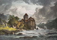
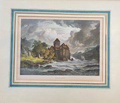
Le chateau de Chillon, Switzerland by Albert Emil Kirchner - Engraving 20x27 cm

Le chateau de Chillon, Switzerland by Albert Emil Kirchner - Engraving 20x27 cm

Located in Geneva, CH

Engraving by Albert Emil Kirchner Dutch artist born in 1813 and died on 1885 He have 176 registered auctions. The oldest was in 1989 and the most recent in 2022 The theme of the engraving is one of the most famous castle in Switzerland "le chateau...

Category

1850s Realist John Speed Art
Materials

Engraving

John Speed art for sale on 1stDibs.

Find a wide variety of authentic John Speed art available for sale on 1stDibs. You can also browse by medium to find art by John Speed in engraving and more. Much of the original work by this artist or collective was created during the 18th century and earlier and is mostly associated with the Old Masters style. Not every interior allows for large John Speed art, so small editions measuring 21 inches across are available. Customers who are interested in this artist might also find the work of Giovanni Benedetto Castiglione, Johann Baptist Homann, and John Webber. John Speed art prices can differ depending upon medium, time period and other attributes. On 1stDibs, the price for these items starts at $681 and tops out at $5,000, while the average work can sell for $681.

Artists Similar to John Speed